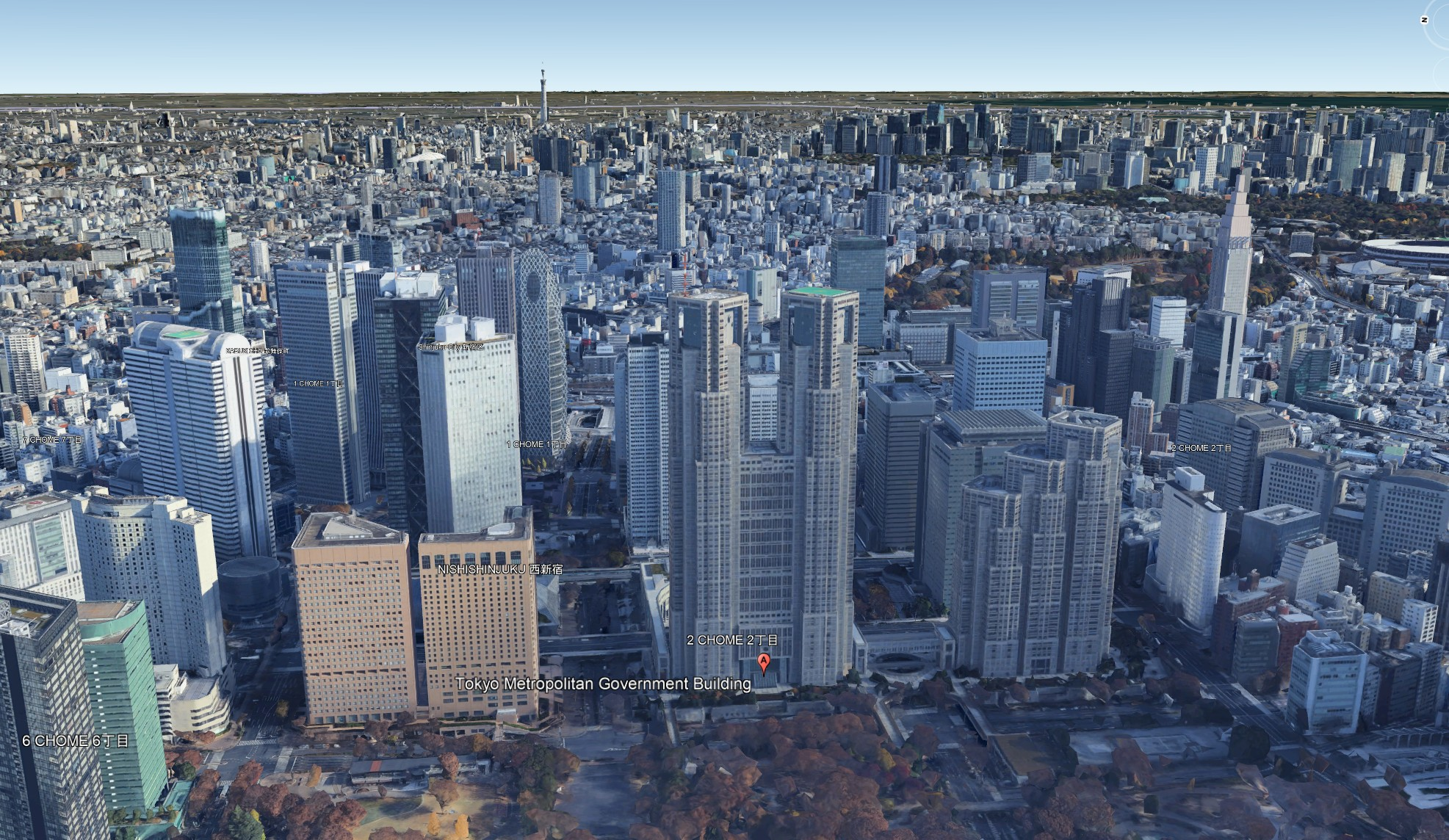
Tokyo Metropolitan Government Building (東京都庁, TOCHO) is the seat of the Tokyo Metropolitan Government that governs the 23 wards of the Tokyo metropolis with 14 million residents in 2023. The 243 meter tall building located in Shinjuku 新宿 has two towers, and each houses an observatory at a height of 202 meters. It had been the tallest building in Tokyo until it was overtaken by the Midtown Tower in 2007.
Enjoy a tune while perusing these photos. Dim your ambient lights and click on the image to enjoy a larger zoom-able version.
For context, here’s a Google Earth aerial view of the Tokyo Metropolitan Government (TMG) Building located in Shinjuku 新宿.
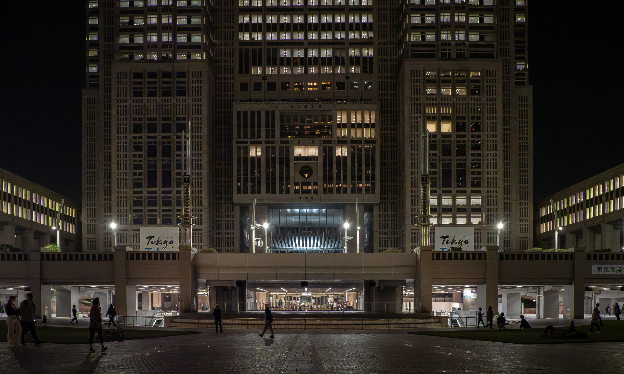
Two panoramic observation decks, one in each tower on floor 45 (202 meters (663 ft) high), are free of charge to the public. It’s about a 10-minute walk from JR Shinjuku Station’s West Exit. On our visit the North tower was open, and the queue was relatively short—roughly a 10-minute wait. Because the complex houses Tokyo’s metropolitan government offices and assembly hall, security includes bag checks before boarding the elevators.
The observation deck is fully enclosed with floor-to-ceiling windows, giving an approx. 300-degree sweep over the city. On the same level you’ll find a gift shop, café, restrooms, and benches. Below are night views facing different directions, along with daylight Google Maps/Earth screenshots for comparable vantage points.
South-East view: On the left, the three-tiered Shinjuku Park Tower with three peaks is home to the Park Hyatt Tokyo and its cinematic “New York Bar,” immortalized in Lost in Translation. The green area with illuminated trees and paths and a well-lit futsal ground is Shinjuku Chou Park. In case you are wondering, futsal is like football but played with a smaller court, a smaller but harder ball, unlimited substitution, a lack of walls (unlike indoor soccer) and no off-side rules.
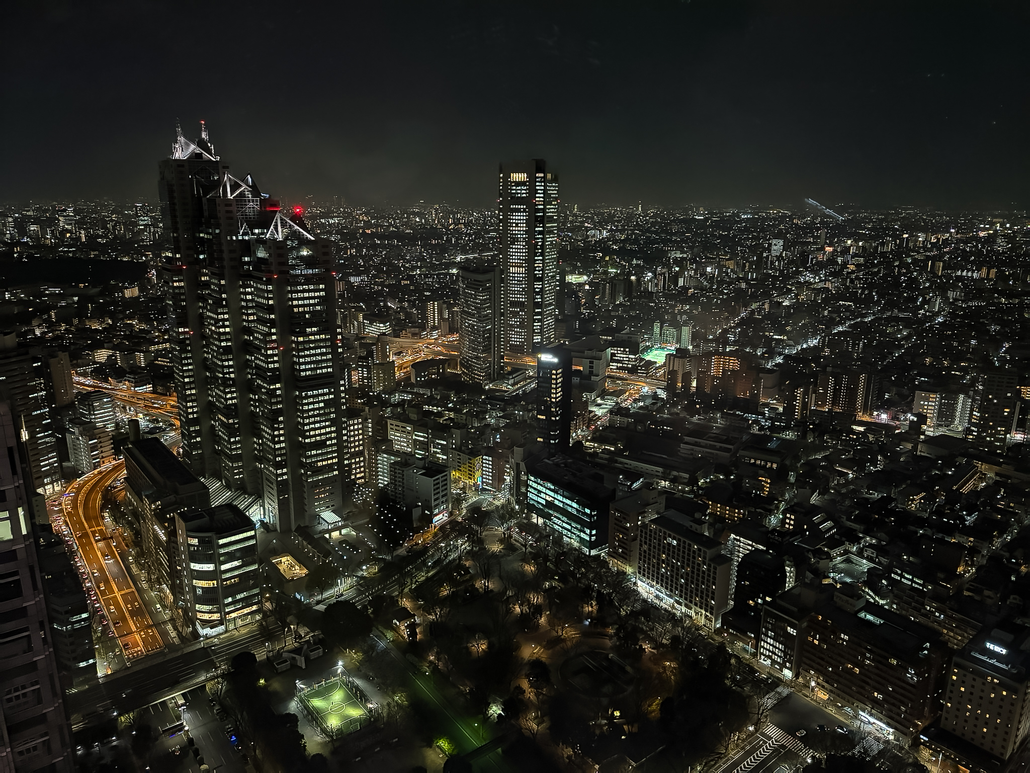
South-East view: same view as above but slightly zoomed in. The tall building in the center is Tokyo Opera City Tower. In the background is the residential Satagaya ward 世田谷区.
Doesn’t these cityscape images feel straight out of Blade Runner (1982)?
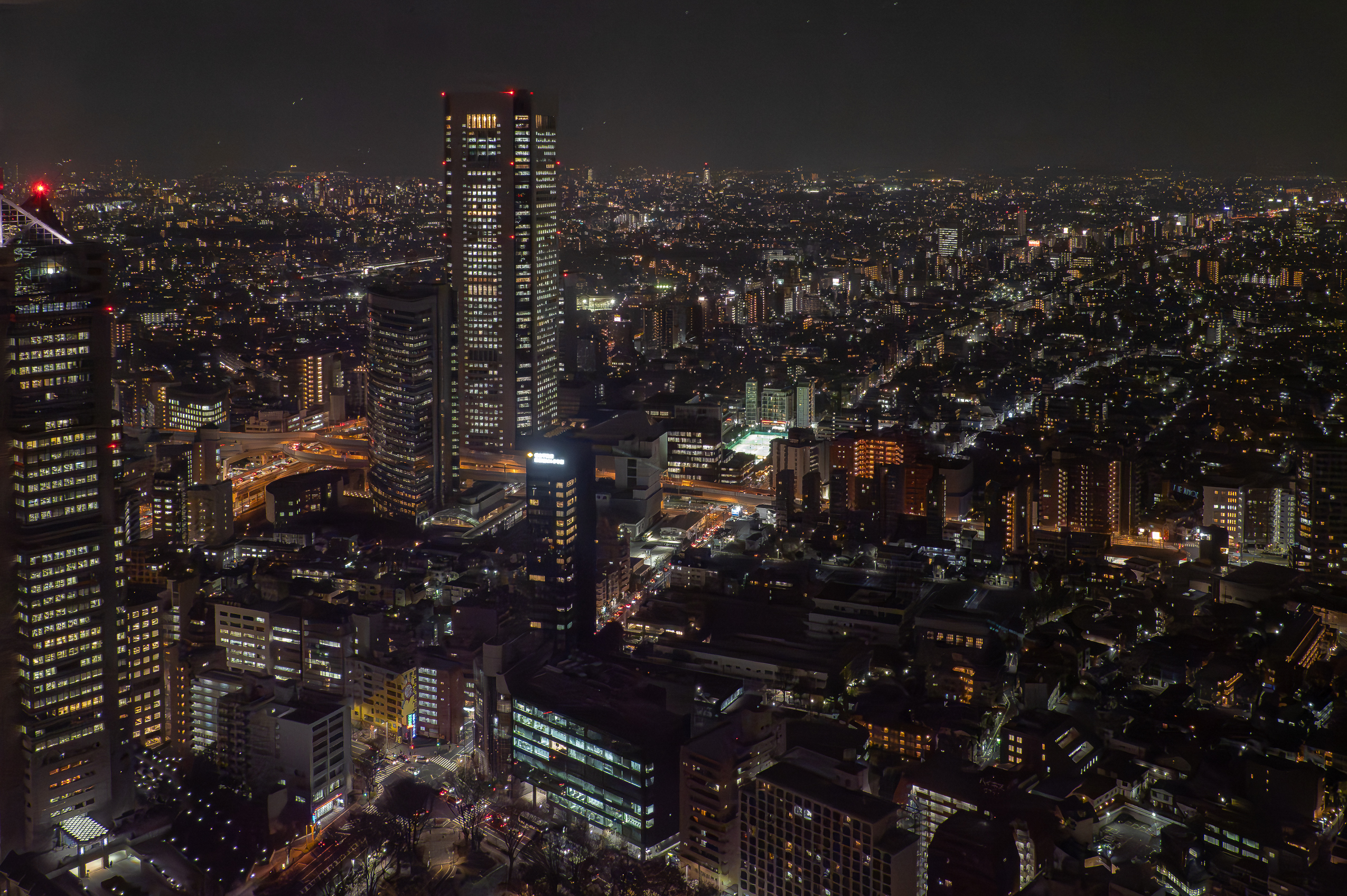
Looking east toward Shinjuku’s main train station, the skyline is anchored by the NTT Docomo Yoyogi Building, its illuminated spire visible across the city. The tower evokes the grandeur of early skyscrapers and is often compared to New York’s Empire State Building. Just below and to the left, the brightly-lit area lies Shinjuku Station, the world’s busiest transit hub. On the far left horizon, the faint red glow of Tokyo Skytree in Sumida Ward is visible marking the eastern side of the metropolis.
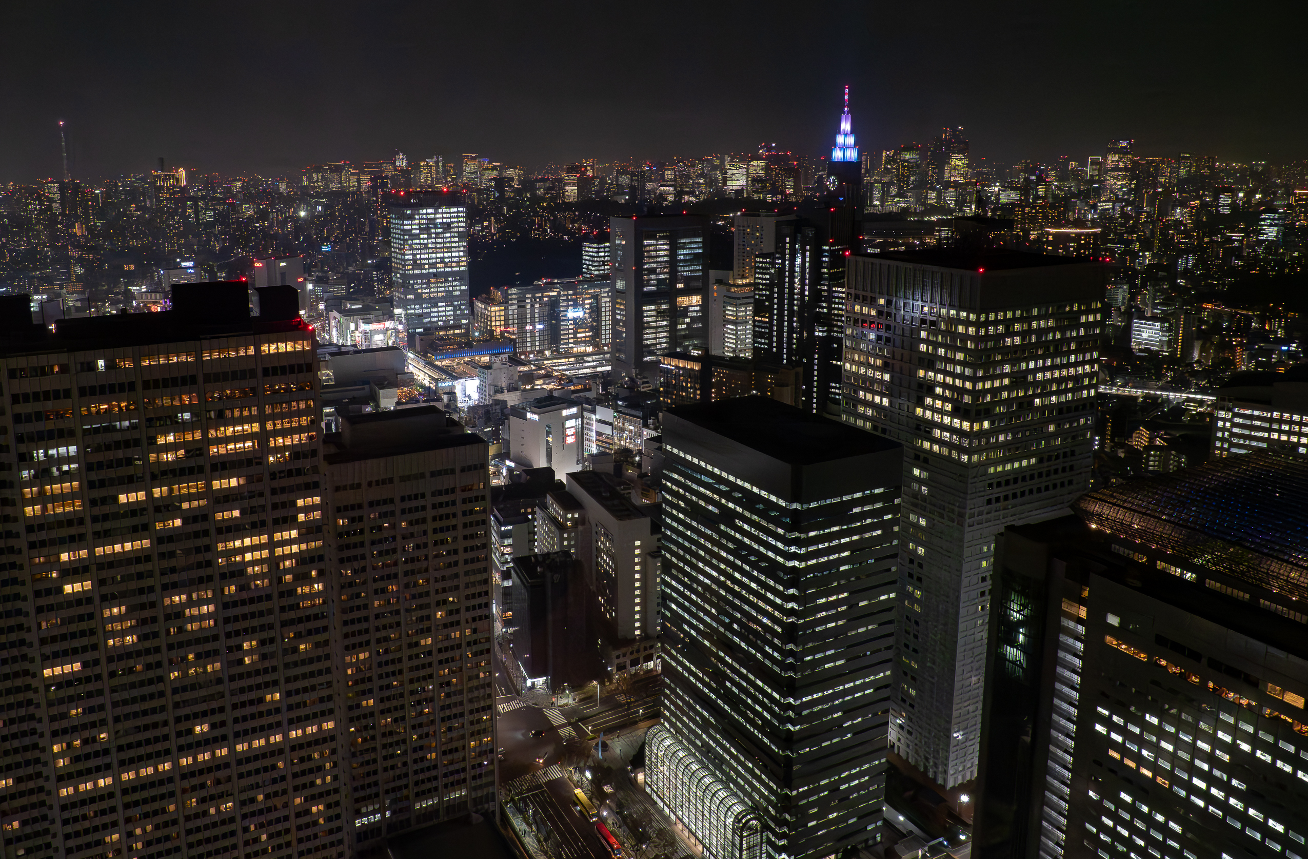
This photo continues from the previous image, shifting the view downward toward the base of the Tokyo Metropolitan Government Building. At the center, the structure with the brightly lit arcade visible in both frames is the Shinjuku Monolith Building. The street running diagonally from the lower left is Gijidō Street (議事堂通り), intersecting Fureai-dori near the middle of the frame. On the lower left stands the Keio Plaza Hotel, while the Shinjuku NS Building occupies the right side. A corner of the Citizen’s Plaza belonging to the Metropolitan Government complex can also be seen within the frame (bottom center).

The tech noir future is here: these Tokyo night views perfectly capture the cyberpunk spirit of Blade Runner. Imagine looking out of the window of a flying taxi.
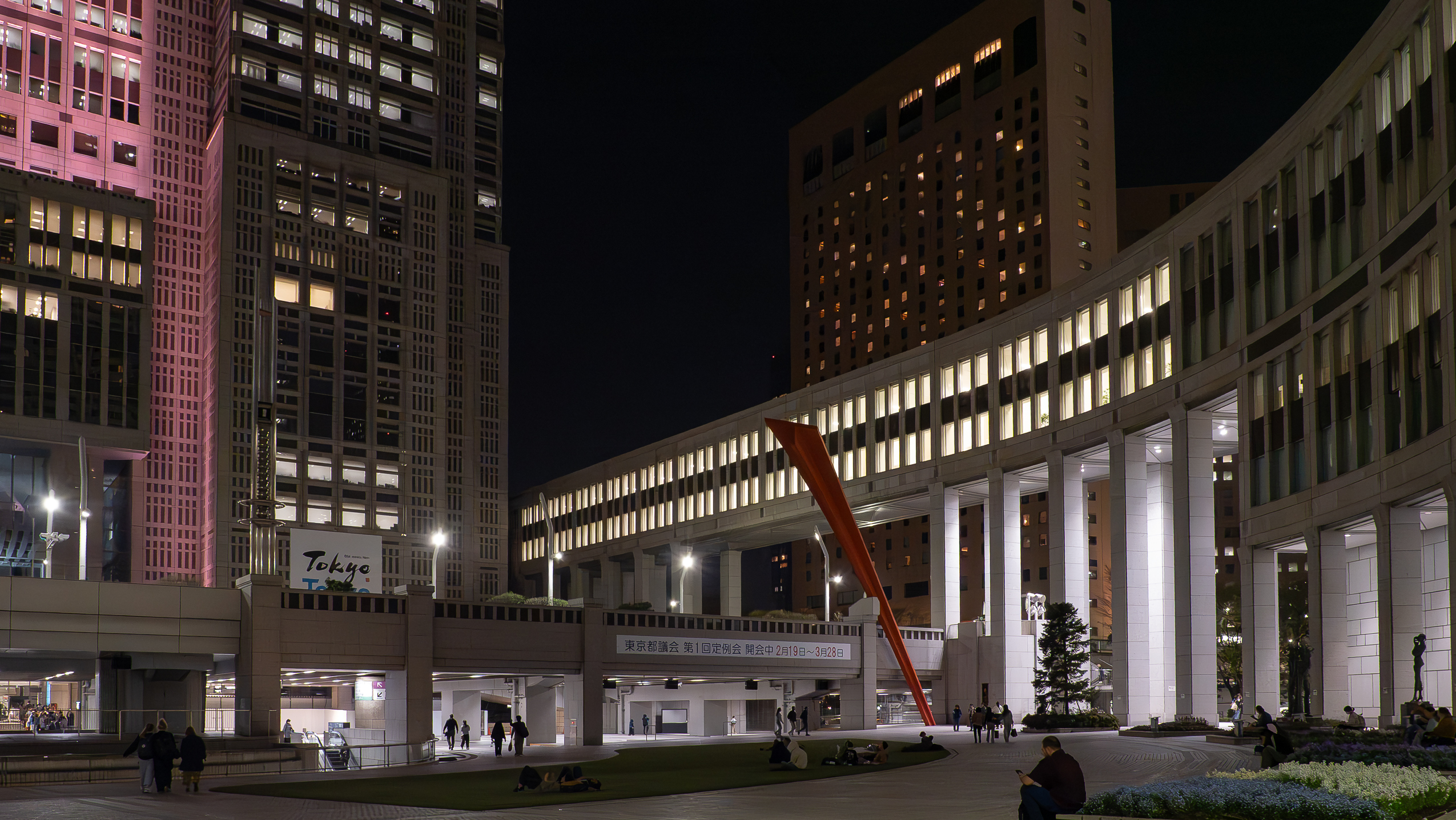
Ground view of the Citizen’s Plaza with the red steel sculpture “My Skyhole 91” by Bukichi Inoue, which is also visible in the photo above from the observation deck.
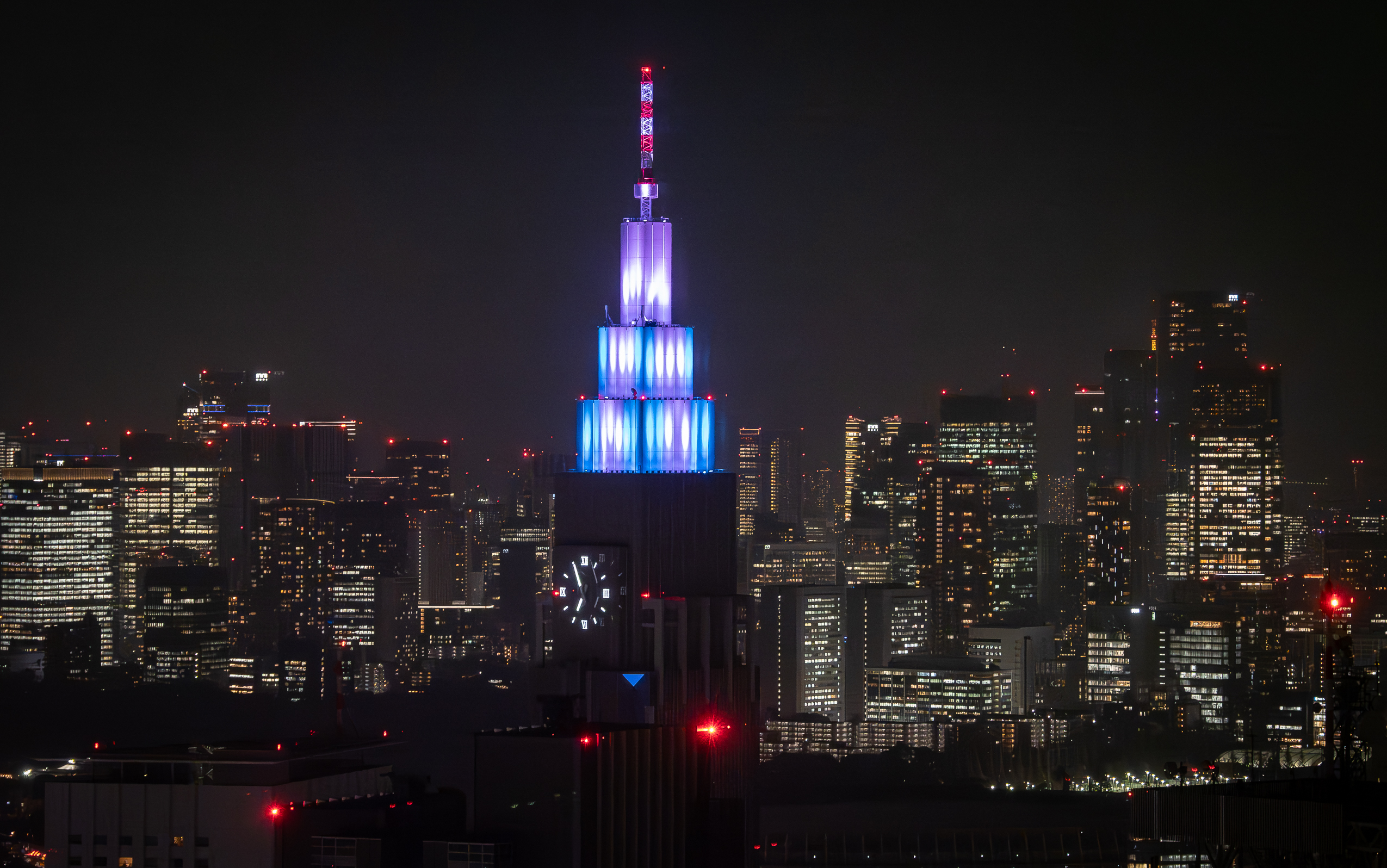
Completed in 2000, the NTT Docomo Yoyogi Building stands 240 meters tall, making it the fourth tallest clock tower in Japan. Its color-changing LED lighting often marks national holidays or special events. Built as a hub for NTT Docomo’s telecommunications operations, it houses advanced infrastructure supporting Japan’s mobile network backbone.
On the horizon, a continuous ring of skyscrapers marks central Tokyo’s business districts—Ginza, Toranomon and Roppongi—forming the city’s eastern skyline beyond Shinjuku.
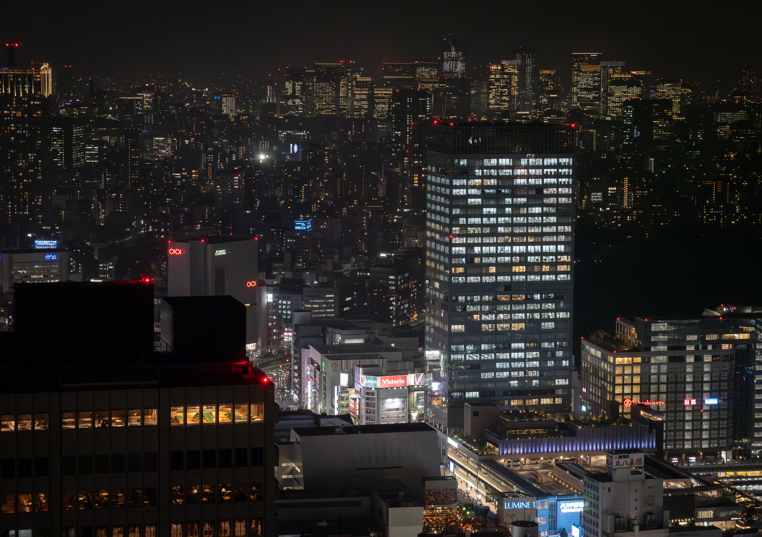
A zoomed-in view of Shinjuku Station west exit: LUMINE 1 (foreground left, turquoise sign) – a major department store directly connected to Shinjuku Station, housing fashion, cafes, and restaurants. NEWoMan Shinjuku (green building, center) – a newer shopping and dining complex attached to the JR Shinjuku South Gate. Takashimaya Times Square (mid-right, large building with blue sign) – a vast shopping center spanning multiple floors, featuring Takashimaya Department Store, Tokyu Hands, Uniqlo, and Kinokuniya Bookstore.
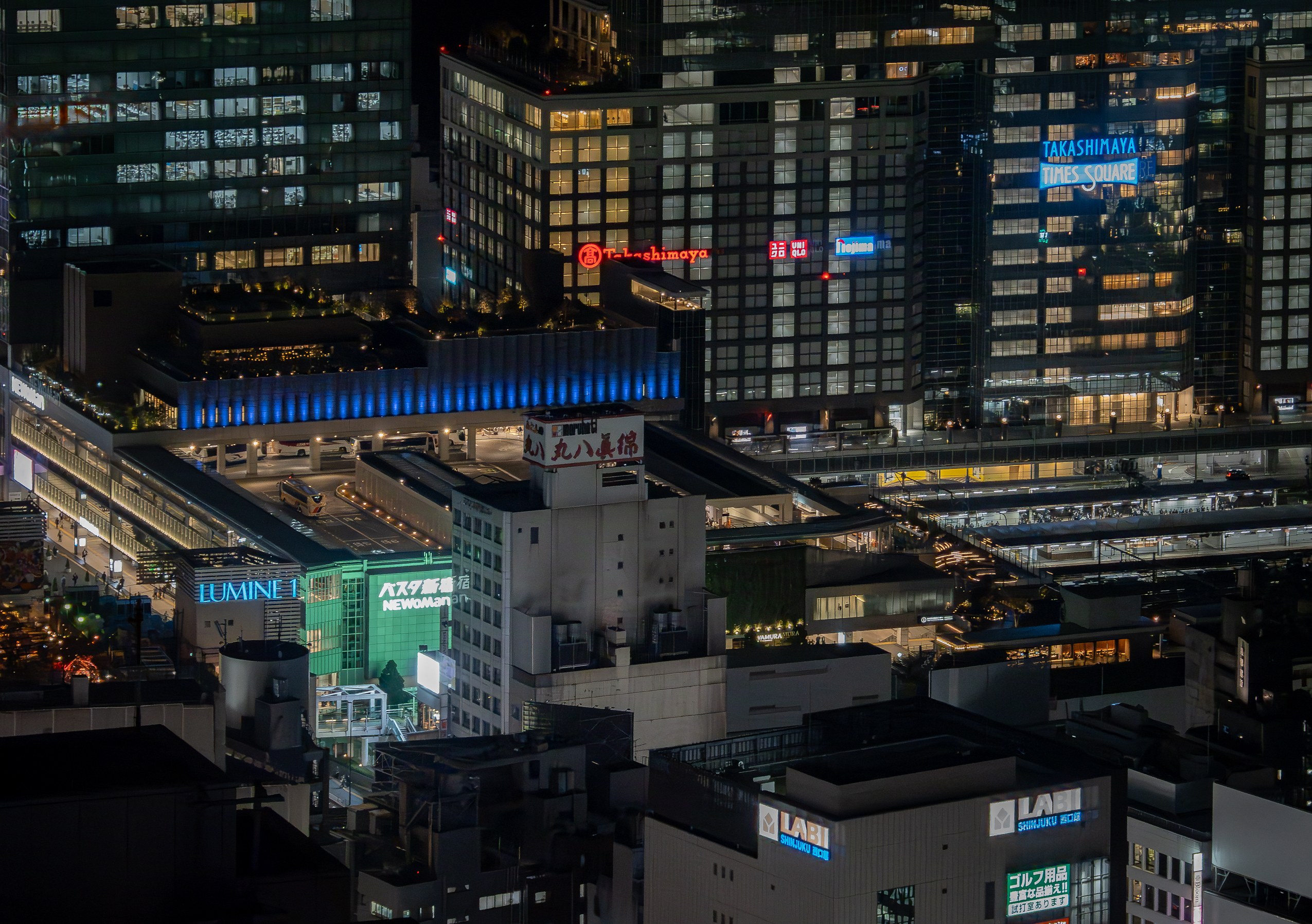
Also visible in the above photo: Bus Terminal Shinjuku (Busta Shinjuku) (behind NEWoMan, lit blue along top) – Tokyo’s largest long-distance bus terminal. LABI Shinjuku Nishiguchi (bottom right corner) – a major electronics retailer, popular for consumer tech. JR Train Platforms (mid-right, beneath the buildings) – multiple layered platforms serving JR East, Odakyu, Keio, and Tokyo Metro lines.
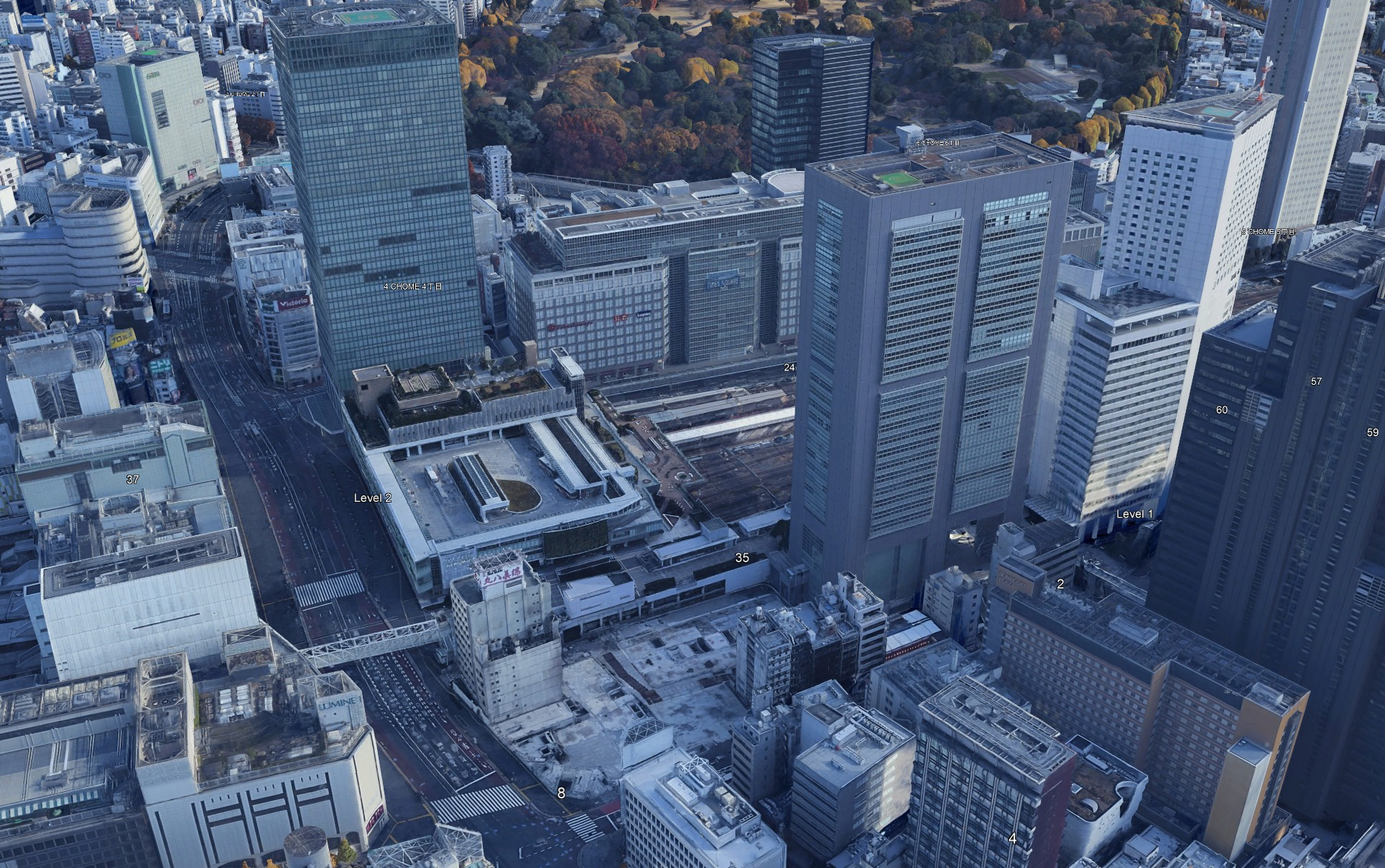
Google Map’s view from a similar vantage point. Visible at the top is the Shinjuku Gyoen National Garden 新宿御苑.
More night panorama photos taken in two other directions are coming in our next post – here.