This is Part 2 of 2 posts on the Musée Carnavalet in Paris. Part 1 is here.
Enjoy a tune while browsing.
Wandering through the Musée Carnavalet is like peeling back time itself, especially if you’re interested in maps, like me (Chris). The museum has several fascinating antique maps on display. As you go from one map to the next, you can see how Paris has changed over time: its boulevards narrower, and the Seine flowed through a denser, less symmetrical city center.
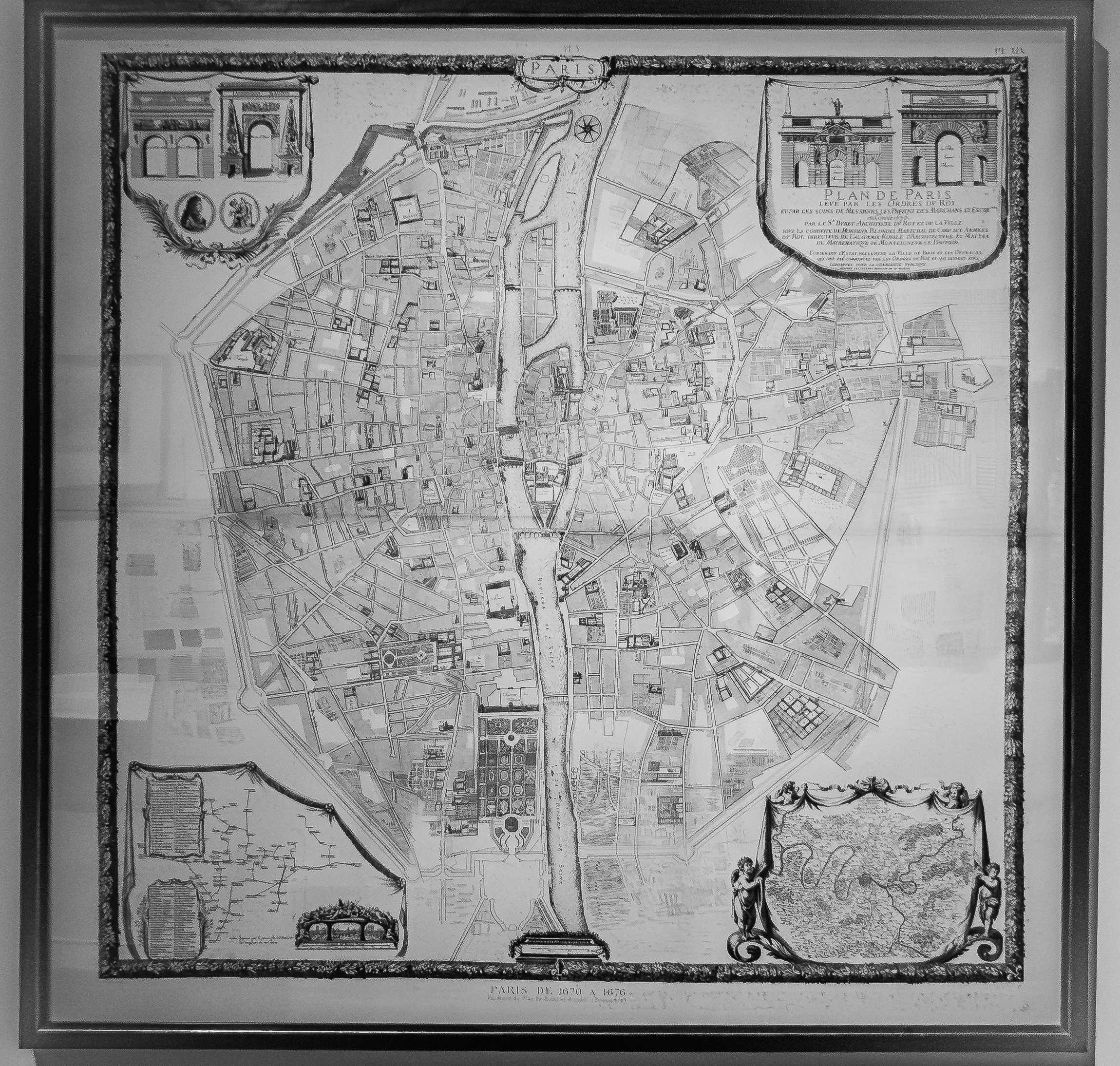
The 1676 Plan de Paris by Jacques-François Blondel, displayed at the Musée Carnavalet, offers a meticulously detailed cartographic portrait of the French capital during the reign of Louis XIV. Engraved with architectural precision, the map reflects François Blondel’s dual expertise as a prominent architect and urban planner. It captures the city’s dense network of streets, fortifications, and major monuments at a time when Paris was asserting itself as the cultural and political heart of Europe.
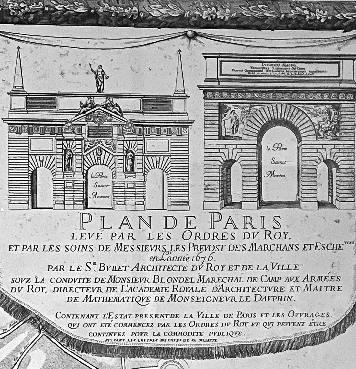
Engraved cartouche from the 1676 Paris map (top left corner of the map) showing gates Saint-Antoine and Saint-Martin. The map was created on the order of François Blondel, who is often credited as the founder of classical architectural theory in France and served as the first director of the Académie Royale d’Architecture, established in 1671.
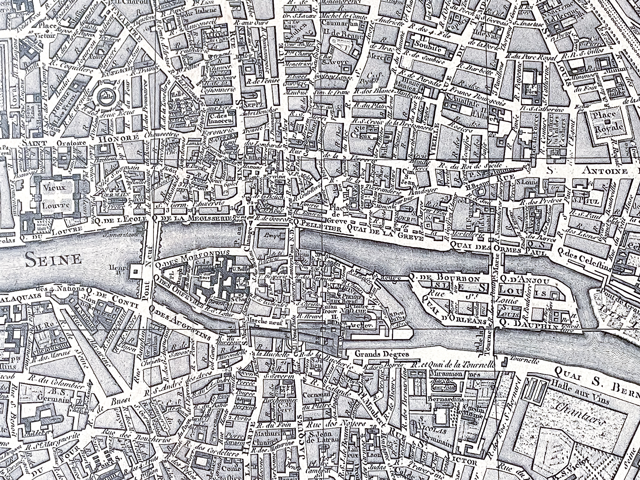
Close-up of the 1676 map shows Île de la Cité in the heart of the city, connected to both banks of the Seine by several bridges. At the top left corner is Pont Notre Dame which connects the island to the Right Bank. In the middle is Pont au Change which was lined with buildings and home to goldsmiths and money changers. Both bridges are still existent, although not in its original form.
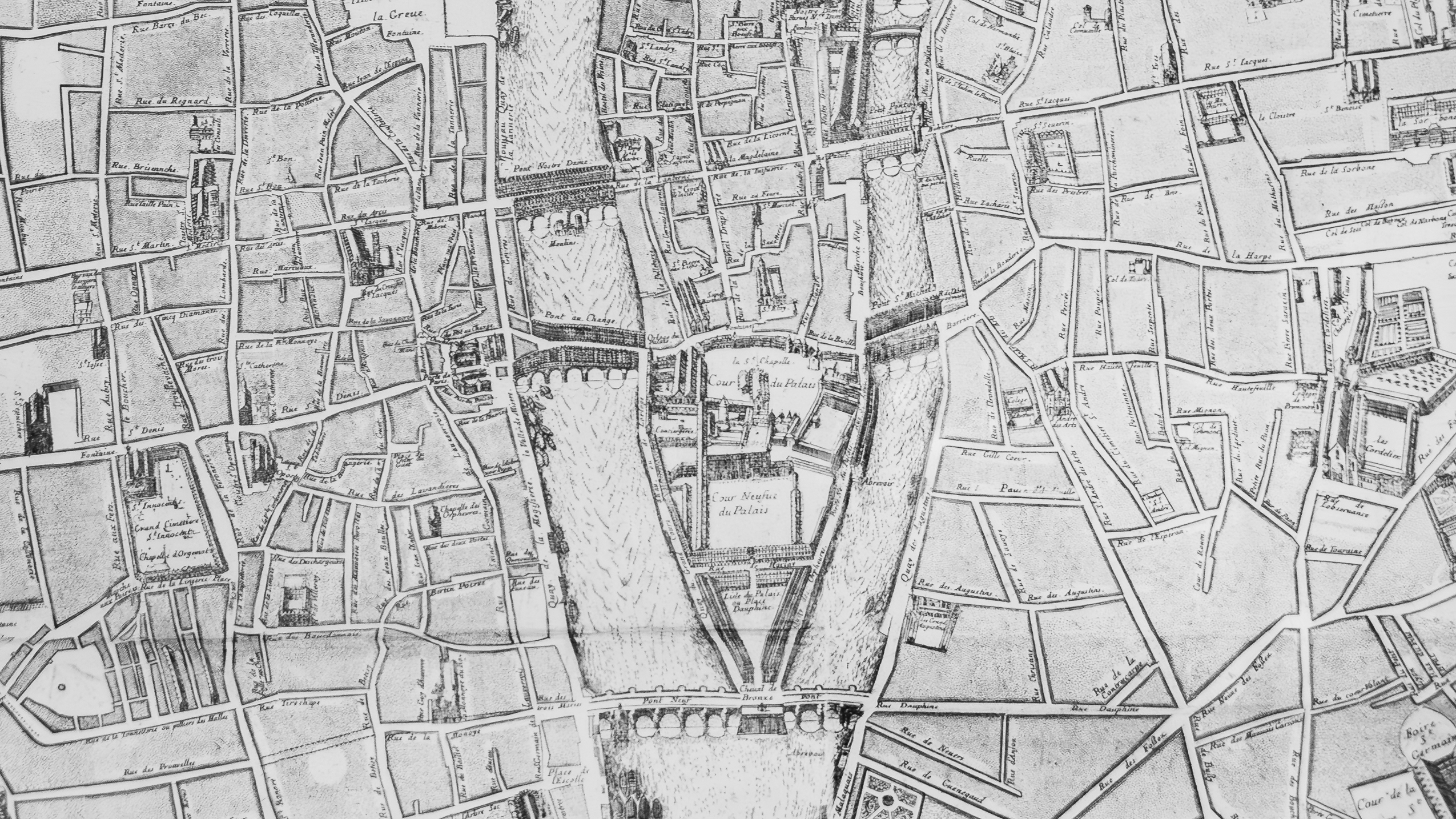
One of the oldest bridge, Petit Pont is also shown connecting the island to the Left Bank near Saint-Michel. Like others, it had been destroyed and rebuilt many times due to floods and fires. It has since been renamed in 2013 as Petit-Pont-Cardinal-Lustiger.
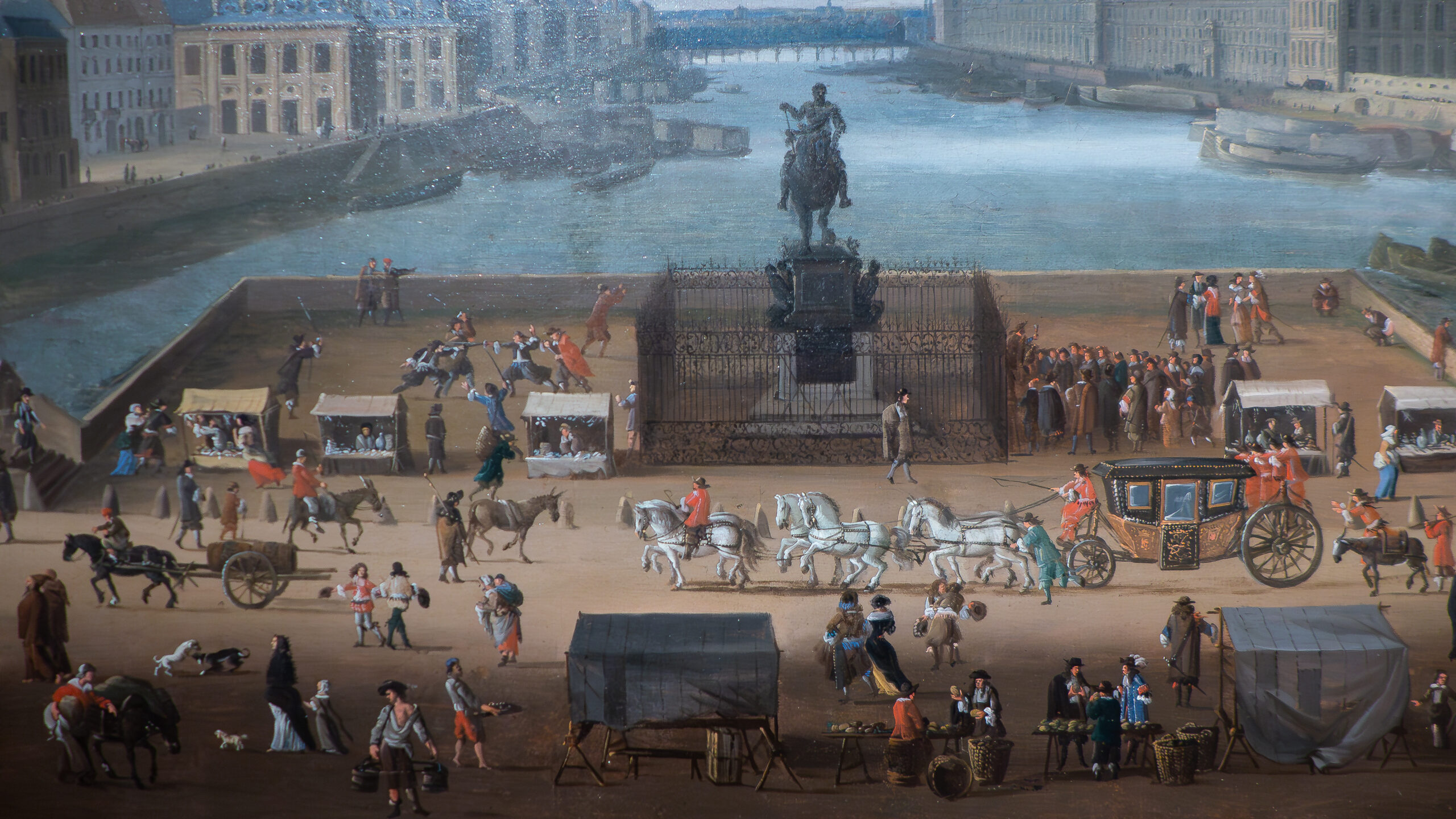
Pont Neuf, completed in 1607, was the most recent addition to the city’s bridges when the map was created—and today, it holds the distinction of being the oldest surviving bridge in its original form. Connecting the Right Bank to the western tip of Île de la Cité and continuing to the Left Bank, it was notably constructed without buildings—an innovative feature at the time—to encourage open circulation and social interaction. Two paintings in the museum vividly portray Pont Neuf and the everyday life that unfolded upon it.
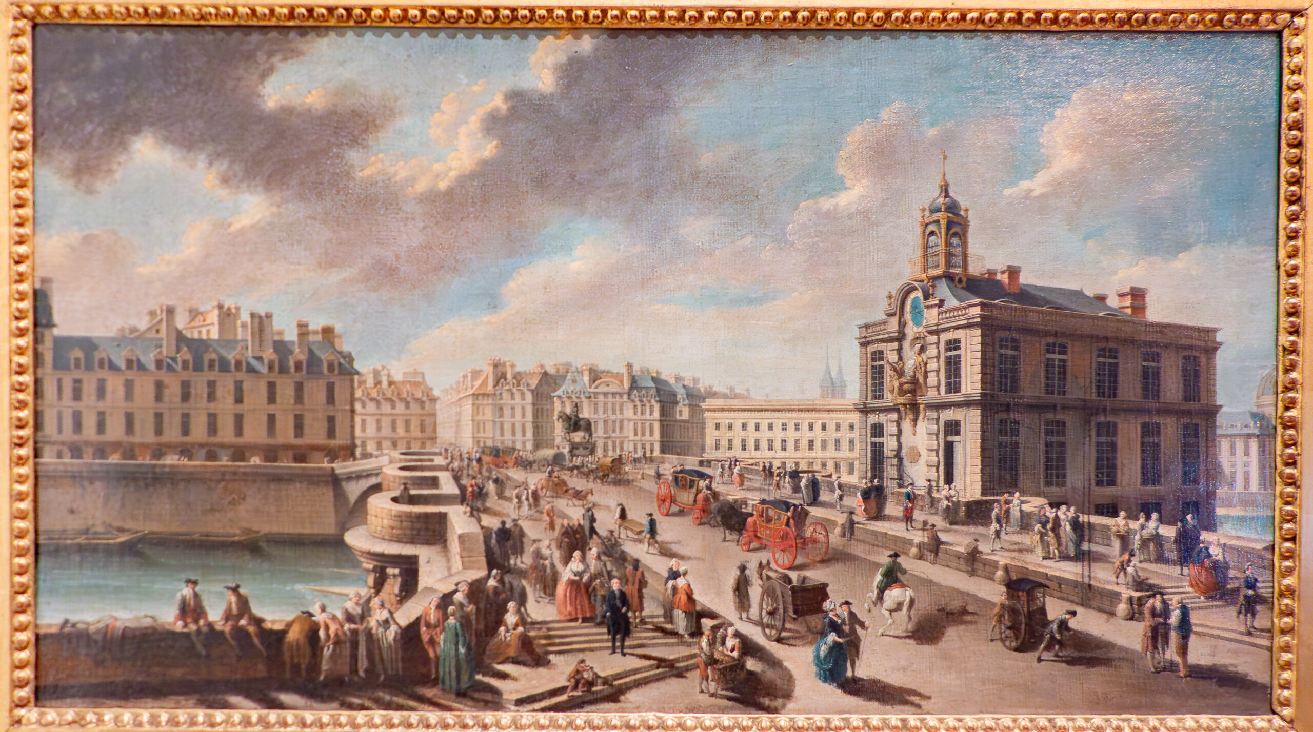
Pedestrians could also step aside into its bastions (see painting above) to let a bulky carriage pass, it serves as a view point over the river nowadays. The bridge was commissioned in 1578 by Henry III. At the point where the bridge crosses the Île de la Cité, there stands a bronze equestrian statue of king Henry IV.
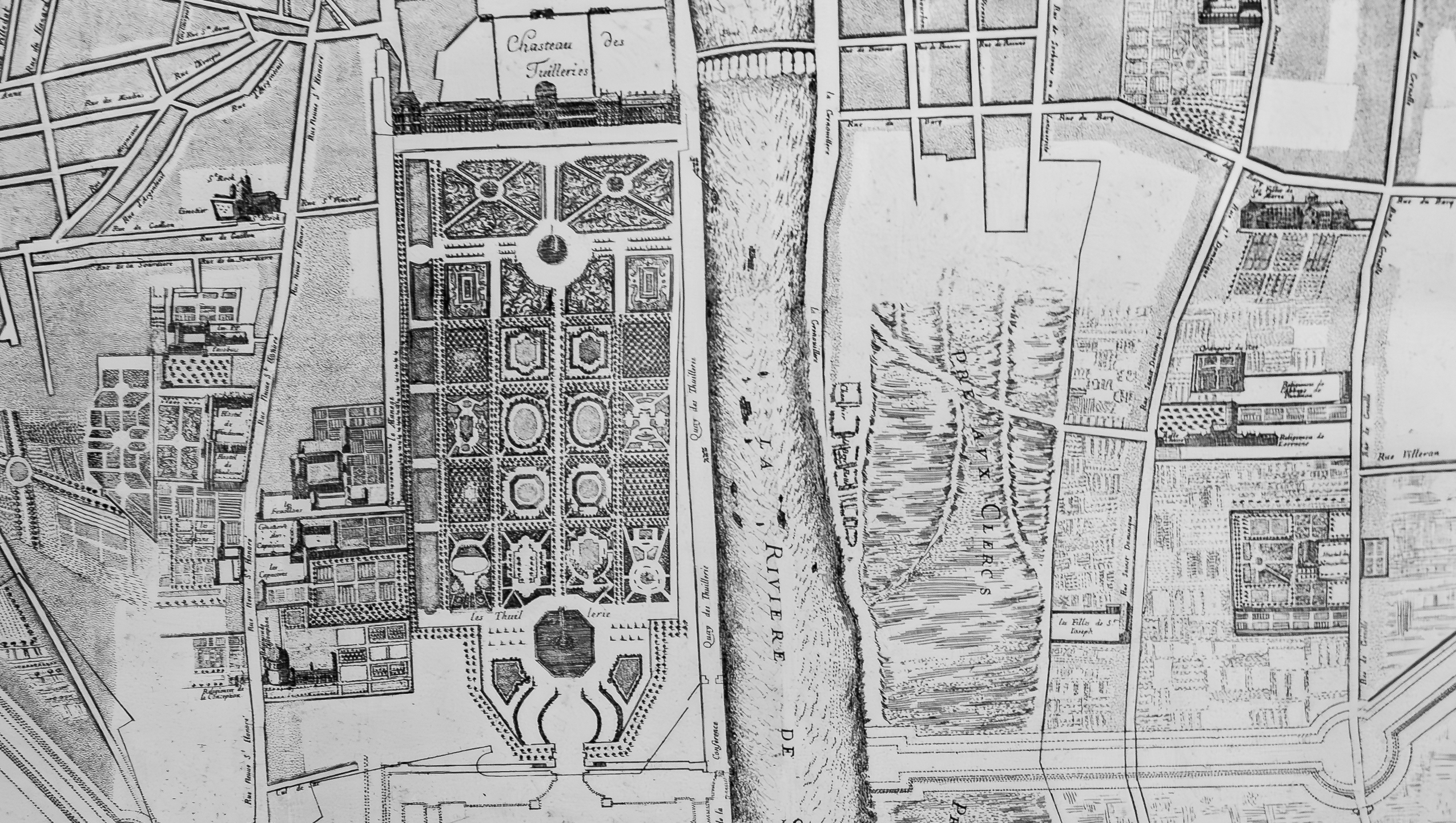
Designed in 1565 for Catherine de’Medici, the Tuileries Gardens were composed initially of a checkerboard of flower beds and a grotto. In 1664, rows of trees were added to line the Grande Allée. To the West, the extension of the garden resulted in a view beyond the limits of the 17th century city, which would later take the name of the Champs-Élysées.
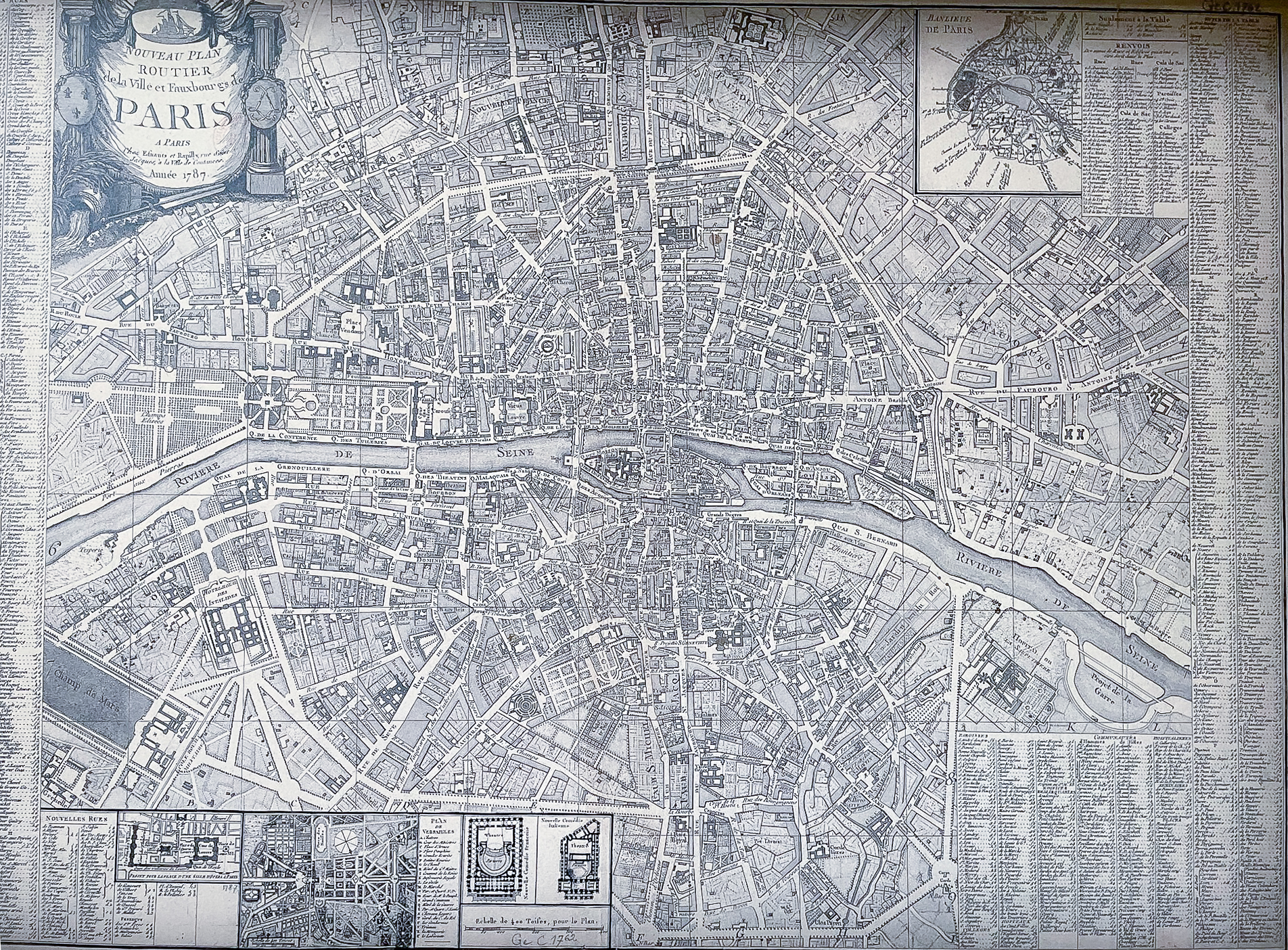
The Nouveau Plan Routier de Paris (1787), published by Esnauts et Rapilly and sold from their shop on Rue Saint-Jacques, is a richly detailed road map capturing Paris on the eve of the French Revolution. The map includes an index of streets and landmarks—typical of “routier” maps, as well as a list of new streets and a small map of the Banlieue (suburbs), a word used back then without the current social and cultural connotations.
Historically, two main thoroughfares visibly traversed Paris along a north-south axis, cutting through Île de la Cité.
(1) Rue Saint-Jacques on the Left Bank crossed the Petit Pont onto the island and continued via Pont Notre-Dame. Once on the Right Bank, it became Rue Saint-Martin, extending north toward Porte Saint-Martin. South of the river, Rue Saint-Jacques followed the path of the Roman cardo, continuing as Rue du Faubourg Saint-Jacques and aligning with the ancient Via Agrippa toward Orléans.
(2) West of this route, Rue de la Harpe also crossed the Seine via Rue au Change and connected with Rue Saint-Denis on the Right Bank—a continuation of another Roman road leading north toward the Basilique de Saint-Denis.
Notably, both the 1676 and 1787 maps show three islands in the Seine, the third being Île Louviers, located just east of Île Saint-Louis. Unlike its neighbors, it was never developed and was eventually integrated into the river’s north bank in 1843. A portion of it is visible in the zoomed-in map above.
Place Royale, the oldest planned square in Paris, appears in all the maps shown here. Commissioned by Henry IV and constructed between 1605 and 1612, it was renamed Place des Vosges in 1799 during the French Revolution to honor the département of Vosges, the first to pay taxes supporting the Revolutionary army. A second public square built under Henry IV—though triangular in shape—is Place Dauphine, which can also be seen in the 1676 and 1787 maps. It sits near the western tip of the Île de la Cité.
Below is a historic Marais map from the late 17th century with labeled hôtels particuliers and a red 5-minute walking-distance overlay. In the center is the Hôtel de Carnevalet.
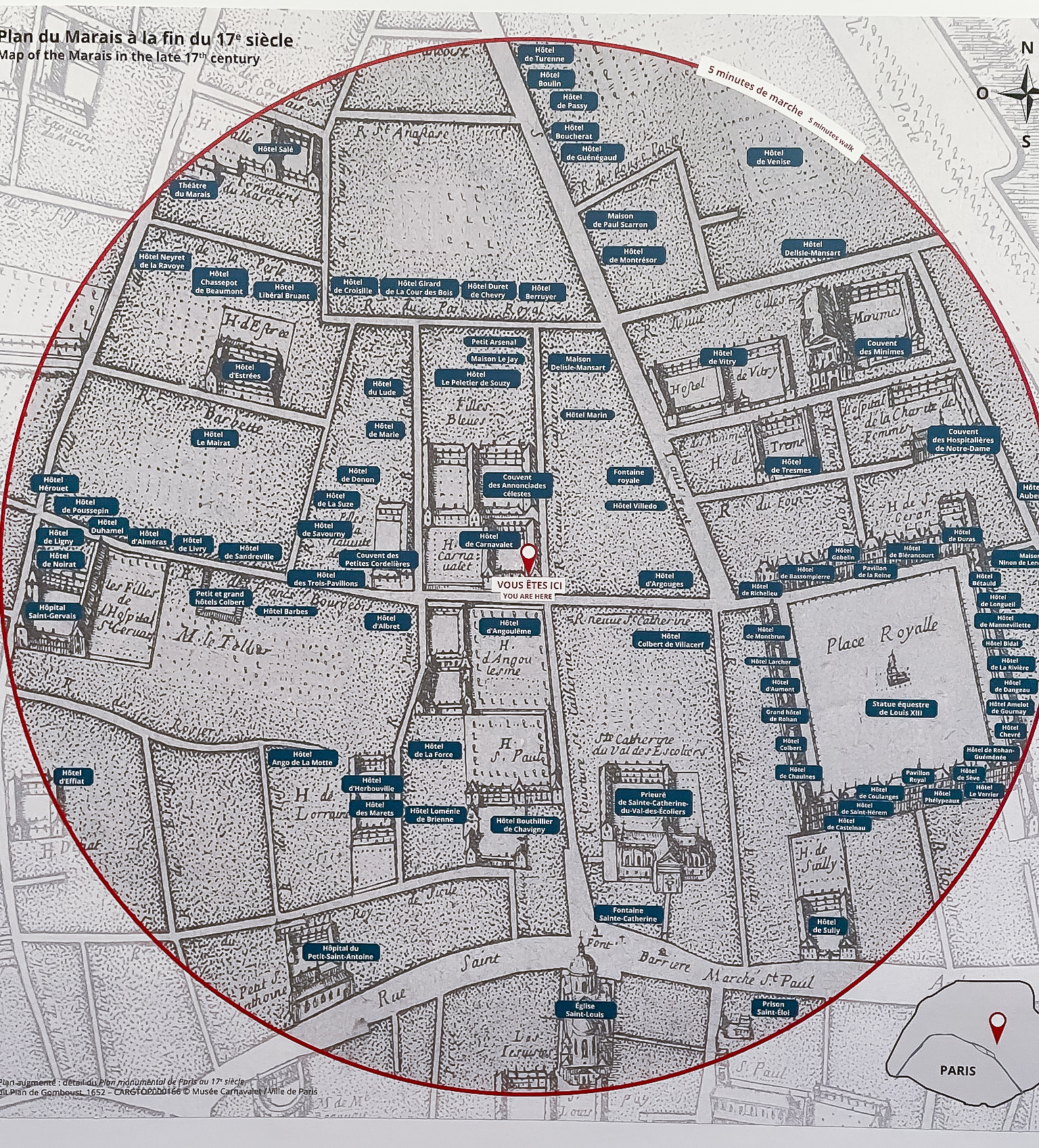
What makes these historical maps so interesting is not merely their age, but the narrative they support from a compact medieval stronghold into the rationality of Enlightenment urbanism, and onward to a modern grid with green spaces—parks, not palaces.
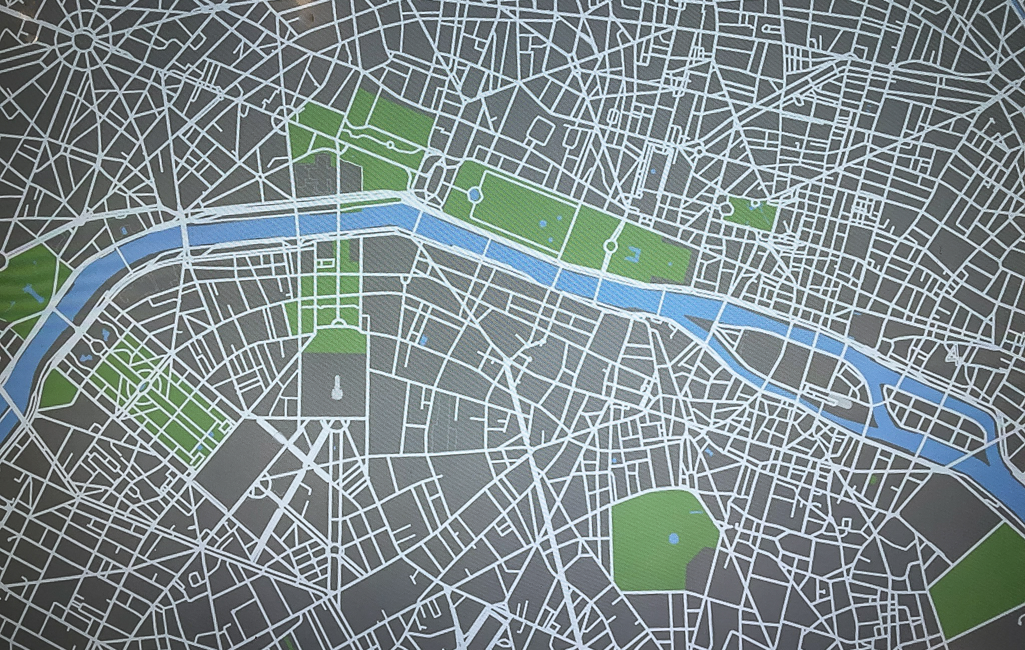
In the museum, a modern map of Paris is presented on a table with an interactive interface that allows zooming and filtering and selective display of map data.
The Musée Carnavalet’s collection allows visitors to visualize the layers of urban history—how memory, ambition, and changes are etched into the streets of Paris. For photos of the exhibits, Part 1 is here.